


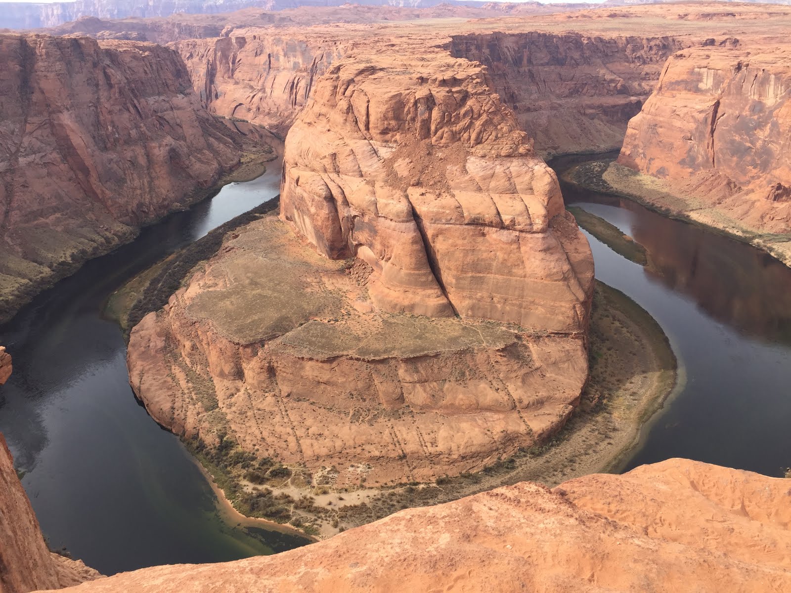
Horseshoe Bend is a horseshoe-shaped incised meander of the Colorado River located near the town of Page, Arizona. Horseshoe Bend is located 5 miles (8.0 km) downstream from the Glen Canyon Dam and Lake Powell within the Glen Canyon National Recreation Area, about 4 miles (6.4 km) southwest of Page. It is accessible via hiking a 1.5 mile (2.4 km) round trip from route 89. Horseshoe Bend can be viewed from the steep cliff above. The overlook is 4200 feet (1,300 m) above sea level, and the Colorado River at 3200 feet (980 m) above sea level, making it a 1,000-foot (300 m) drop. The rock walls of Horseshoe Bend contain a variety of minerals, among which are hematite, platinum and garnet.


Glen Canyon Dam - Lake Powell
Glen Canyon Dam is a concrete arch - gravity dam on the Colorado River in northern Arizona, near the town of Page Utah. The 710-foot (220 m) high was built by the U. S. Bureau of Reclamation from 1956 to 1966 and forms Lake Powell, one of the largest man-made reservoirs in the U. S. with a capacity of 27 million acre-feet (33 km3). The dam is named for Glen Canyon, a series of deep sandstone gorges now flooded by the reservoir; Lake Powell is named for John Wesley Powell, who in 1869 led the first expedition to traverse the Colorado's Grand Canyon by boat. Today the water level is 76 feet below normal levels.


The Grand Staircase-Escalante National Monument is a U. S. National Monument protecting 1,880,461 acres (760996 ha) of land in southern Utah. There are three main regions: the Grand Staircase, the Kaiparowits Plateau, and the Canyons of the Escalante - all of which are administered by the Bureau of Land Management. It was designated as a national monument in 1996. Grand Staircase-Escalante encompasses the largest land area of all the U. S. National Monuments.


TTFN:
Beautiful scenery my brother. Hope KW and CJ enjoyed the big hole in the ground.
ReplyDelete